Chatter News Photo Galleries & Information on Cat Skiing ____________________________________
| Chatter News | Road to Vertebrae Glacier | Glacier Skiing | Bombardier Snowcat | Favorites |
| Lodge Life | Vertebrae Lodge | Solitude Lodge | Happy Campers | Pink Purse | Winter Staff |
Ski Photography by: | John Dougall | Mark Gallup | Dan Hudson | Rob Plato | Site Map | Index |
| Chatter Creek Cat Skiing | Clamshell | Cut Blocks | East Ridge | Lodge Ridge | Great Links |
| Cat Skiing Terrain | Cat Skiing Articles | Flight to Chatter Creek | Travel to Golden | Email |
Terrain Quick Links: | South Side | West Side | Lodge Ridge | Stovepipe | Glacier | East Ridge |

Wednesday, April 20, 2005

Glacier Skiing at Chatter Creek

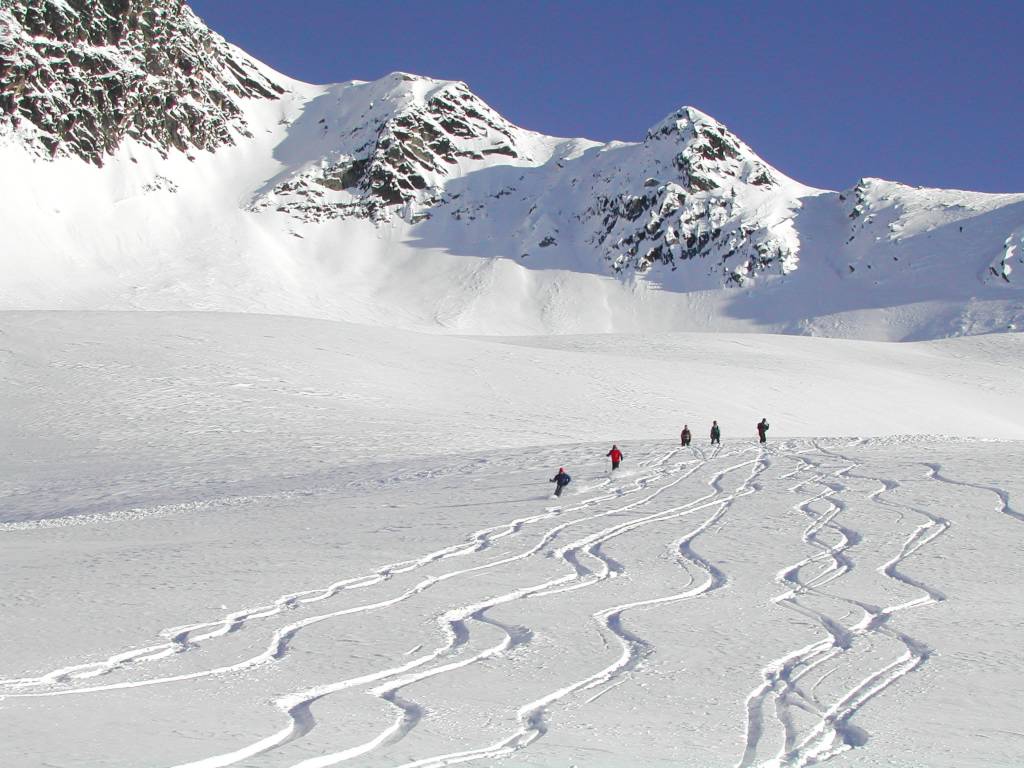
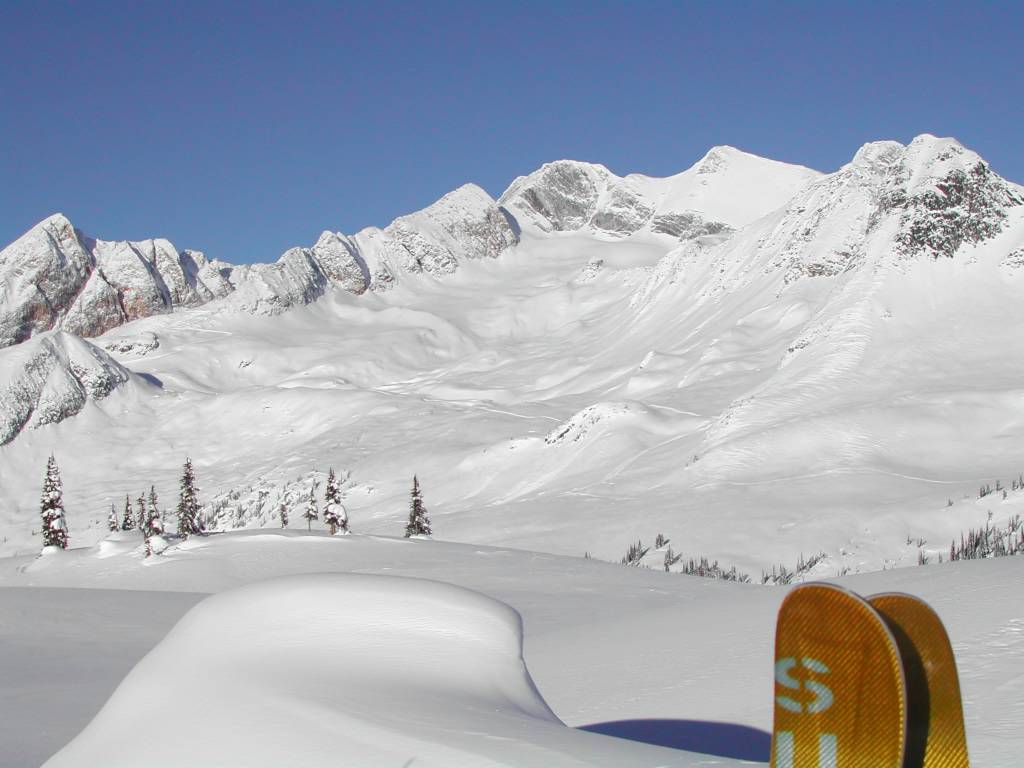
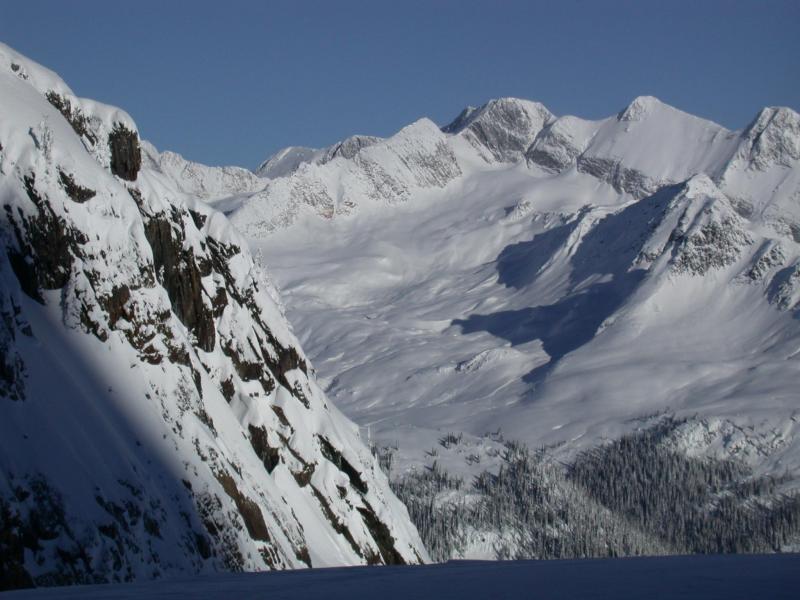
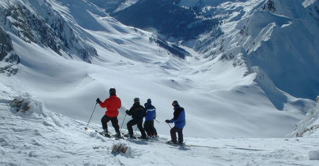
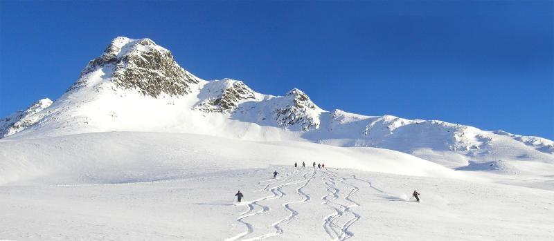
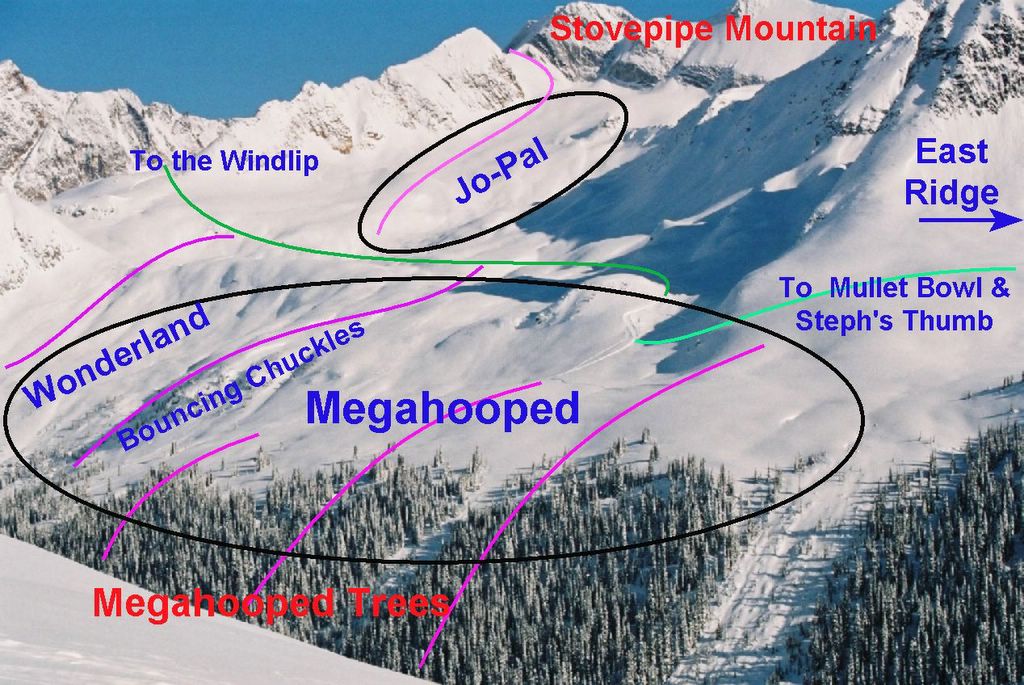
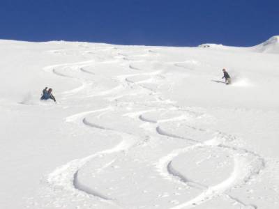
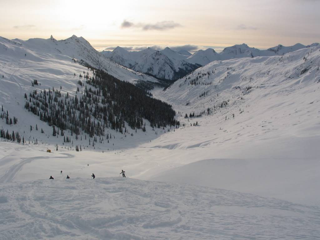
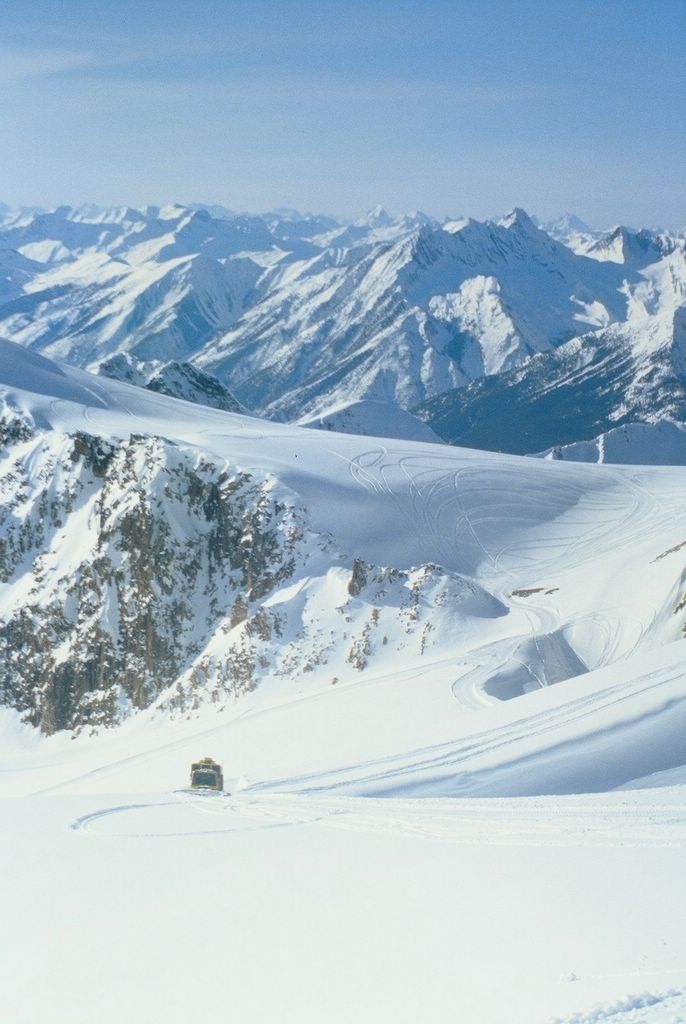
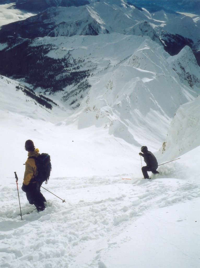
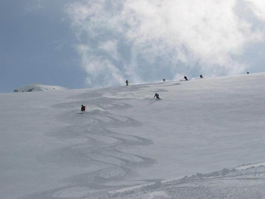
The Vertebrae glacier provides extensive glacier skiing and marvellous views at Chatter Creek cat skiing. Vertebrae glacier lies on the eastern slope of Stovepipe Mountain. Access to the glacier is by road that must climb the western side of the mountain and cross to the east near the highest point. The return from Vertebrae glacier offers a variety of great powder skiing on the Windlip, Jo-Pal and Megahooped.

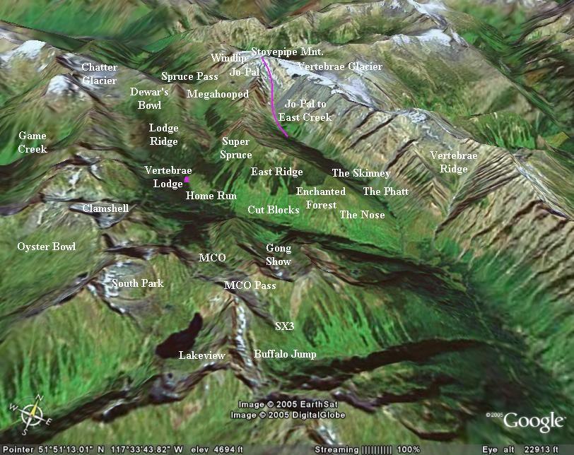
The road to Vertebrae Glacier leaves Vertebrae Lodge to the east. Besides Vertebrae Glacier, the road services Spruce Pass, Mullet Bowl and Steph's Thumb as well as Megahooped & Jo-Pal, and the Windlip. The Mullet Bowl branch now crosses over East Ridge, north of Super Spruce to provide a pickup route from East Creek.
                                        Return to Road Network Index

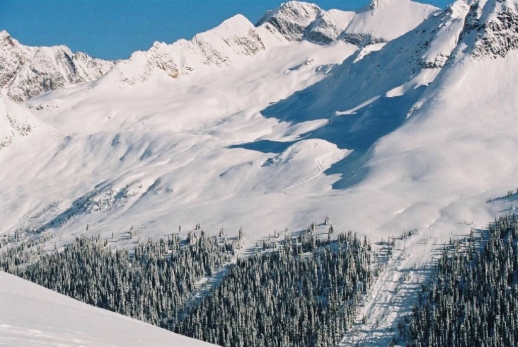
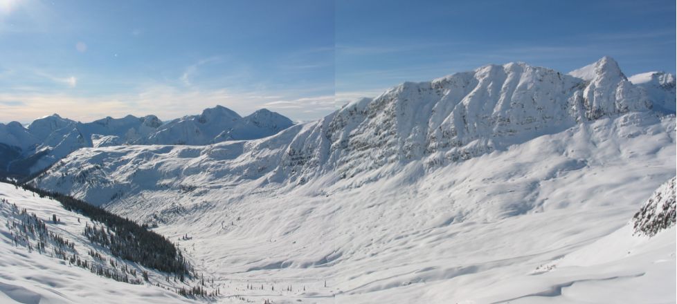
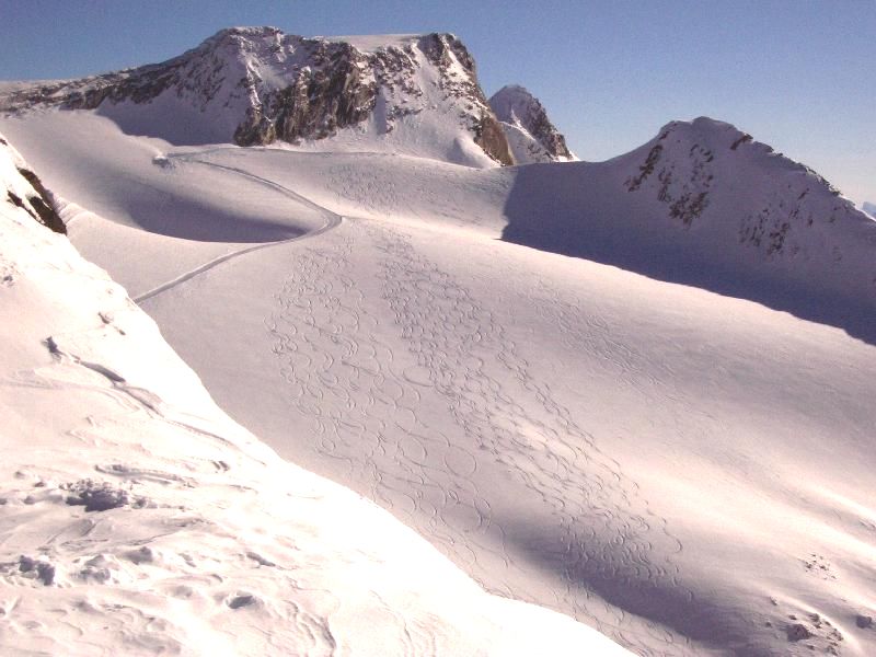
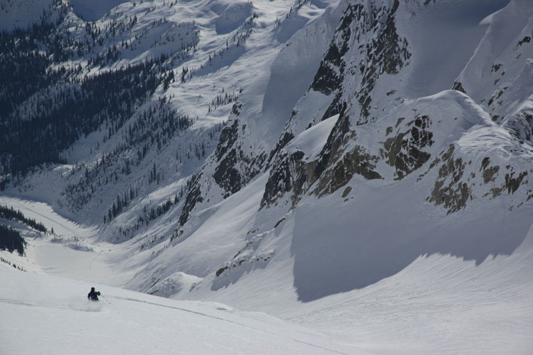
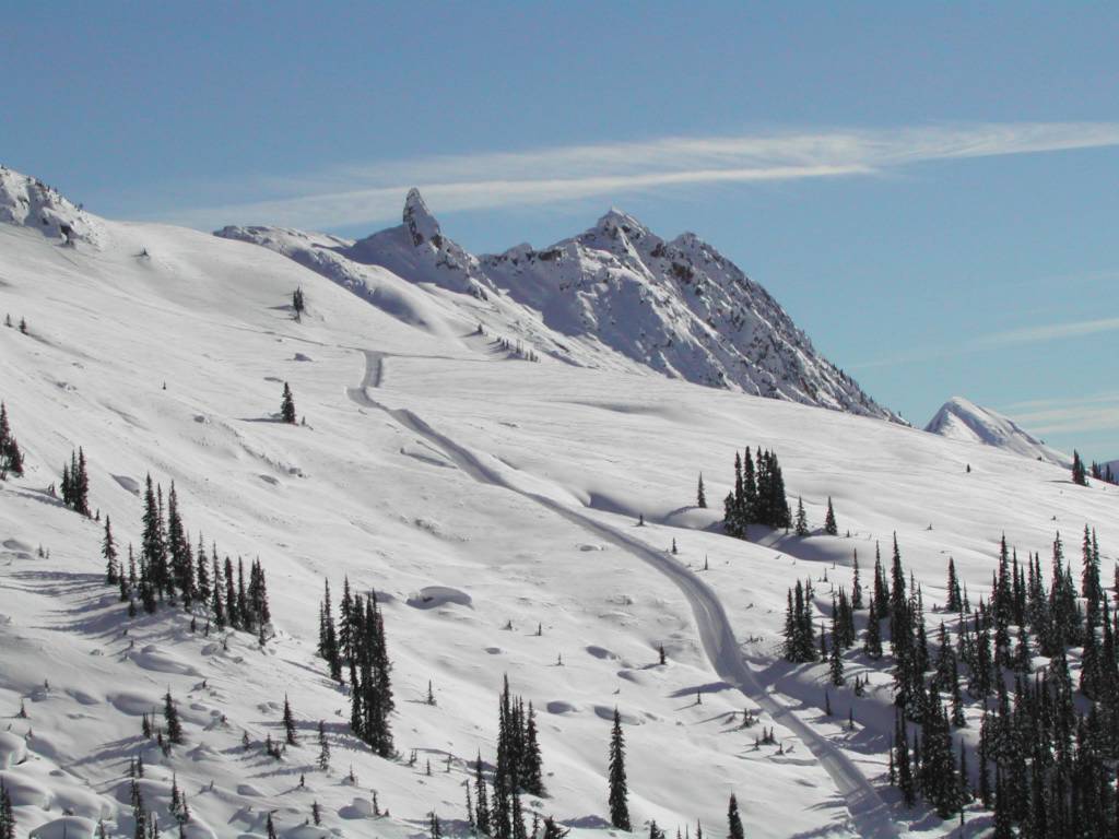
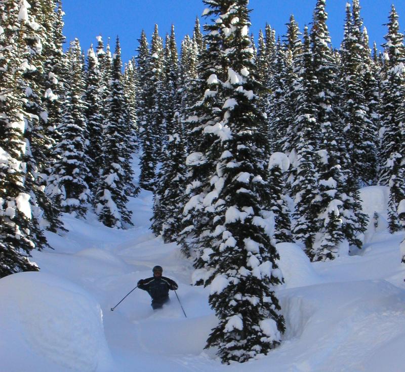
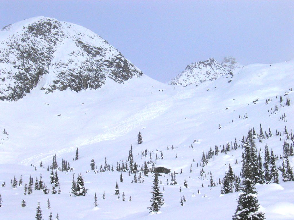
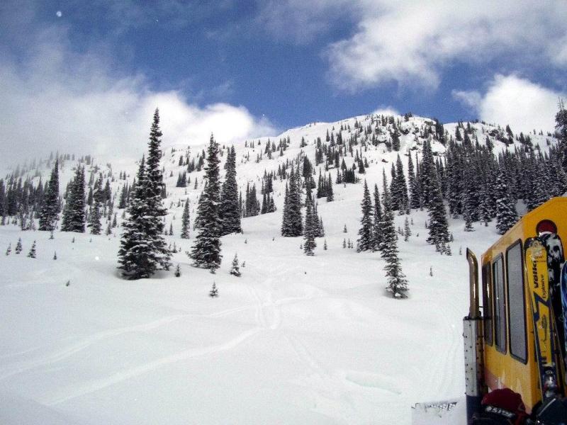
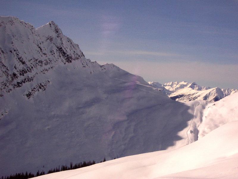
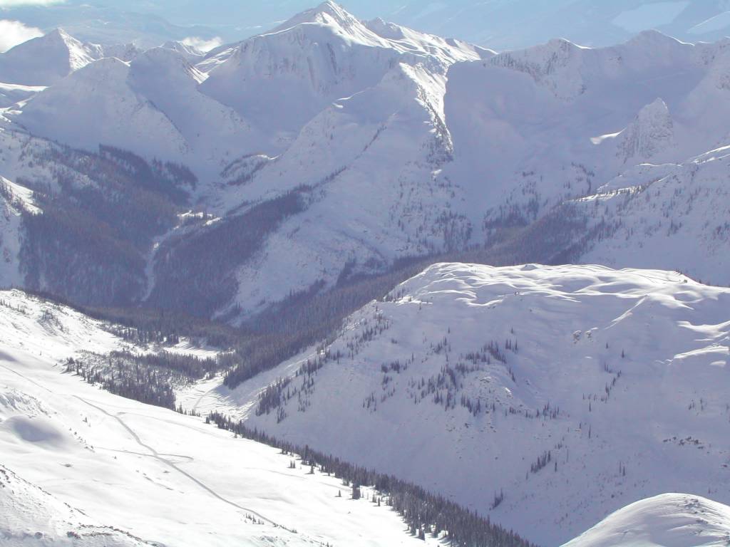
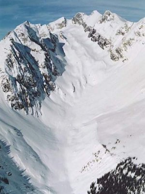
From the lodge, the road climbs across the Home Run on the south end of Lodge Ridge and enters the alpine in the Spruce Creek gully between Lodge Ridge and the Megahooped trees (see Fig. 1a to the right).    The road can be seen traversing the gully in the lower left corner of the photo below.

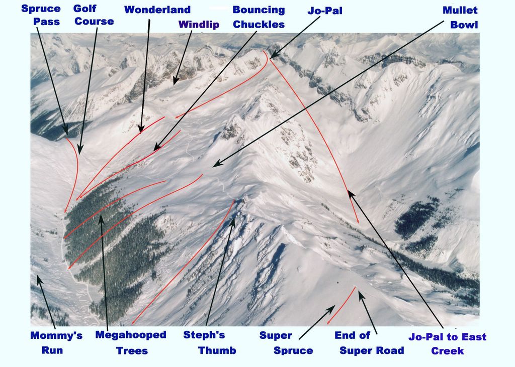
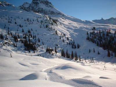
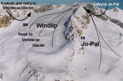
Beyond the Megahooped Trees, the road forks and the Spruce Pass road branches to the north. The main road then turns back to climb above the Megahooped trees where it again forks. The main road climbs to a bench and turns north again to cross above Megahooped before passing out of sight in the photo and onto the Windlip. On the Windlip, the road climbs to the Keyhole, which is the entry to Vertebrae Glacier. This is hidden in the photo by the ridge at the top left-center of the photo. Near the Keyhole, the road again forks and a branch continues to the top of the Windlip and the entrance, at the top center of the photos, to Jo-Pal. Click Fig. 1b at the right to see these names marked on the photo.

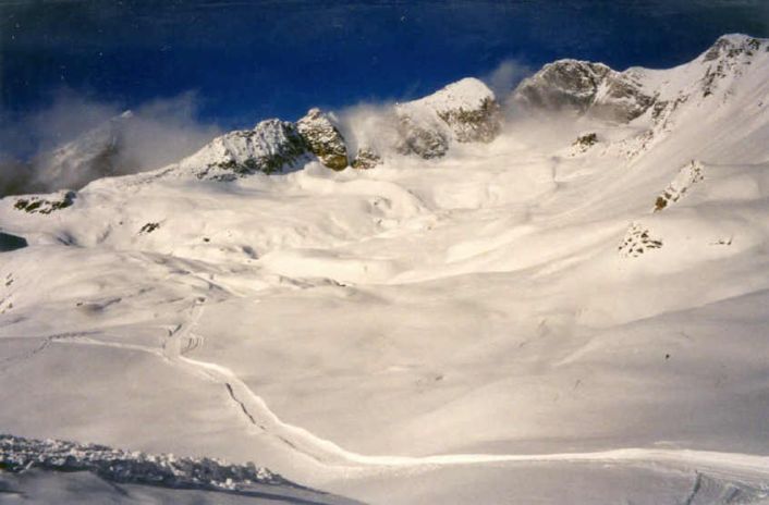
From the fork above the Megahooped trees, a branch leaves to the south to Mullet Bowl and Steph's Thumb.


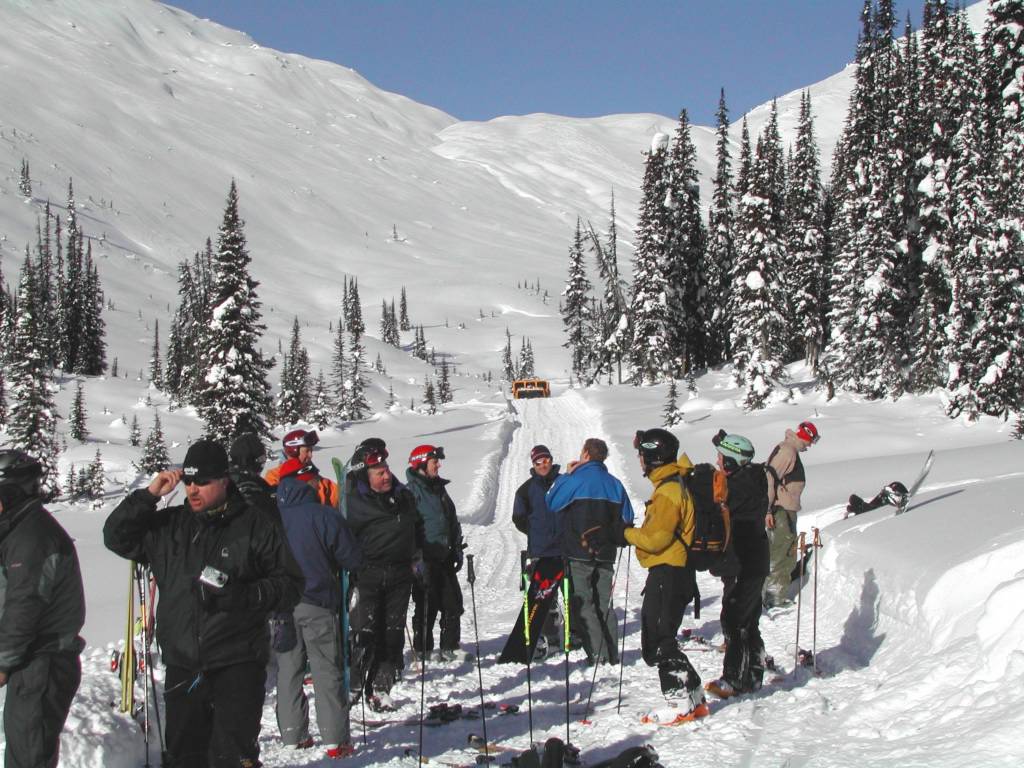
Scroll down to see vistas and ski terrain on the Road to Vertebrae Glacier. This site is a part of the Chatter News, which gives a client's perspective on snowcat skiing at Chatter Creek.

Powder Skiing at Chatter Creek Snowcat Skiing
There's lots of mellow powder skiing in Mullet Bowl, between Megahooped and Steph's Thumb. Lines in Mullet Bowl drop into the southern end of Megahooped Trees.

Click on any Chatter News image to enlarge it. Use the Browser's "Back" button to return.

Megahooped and Jo-Pal

Powder Skiing at Chatter Creek
The cat road to Vertebrae glacier can be seen climbing Stovepipe Mnt from the left of the "Megahoop" trees, across the hill to the right (Fig. 2 to the right) and disappearing into the shadows. It then reverses direction to traverse the bench that separates "Megahooped" on the lower slope from Jo-Pal, on the upper slope. At the left of the photo, the road skirts the end of the sharp ridge to the north of Jo-Pal and passes onto the Windlip.    Wonderland and Bouncing Chuckles are below the bench, within Megahooped.   Click on Fig. 3 on the right to see the area names.

This slope provides many lines on the return trip from the Vertebrae glacier, which lies beyond the rocky summit of Stovepipe Mountain at the top center of this photo.

Spruce Creek Gully


In the Spruce Creek gulley between Lodge Ridge and Megahooped. The Megahooped Trees are on the right. Wonderland is visible on the far hillside. Bouncing Chuckles is also on the far hilside, but is mostly just hidden by the trees.       Photo:Wendy Robinson

The road forks ahead. The road to Vertebra glacier turns to the right and up the hill. The road to Spruce Pass continues and disappears out of the picture to the left.

Powder Skiing at Chatter Creek
A group in the Spruce Creek gully ready for pickup after skiing the Megahoop trees. The eastern slope of Lodge Ridge is seen on the left. Spruce Pass and the Golf Course appear in the background. The same pickup serves Mommy's Run and Crystal Lite on Lodge Ridge.


Waiting for the cat at the bottom of Bouncing Chuckles. Megahooped Trees are on the left and lower Lodge Ridge and Mommy's Run forms the background. The pickup for the Golf Course run from Spruce Pass is further down the hill.

Fig. 7a to the right shows the view back up the hill. Fig 7b is a view across Bouncing Chuckles from the Spruce Pass road. Fig 7c. shows Spruce Pass and the Golf Course on the left, and Wonderland on the right, beyond the end of the Megahooped Trees.

In Fig 8. to the right, Rick and Jack take a rest on Jo-Pal. Far below in the valley, the Megahooped Trees can be seen on the left, and the lower Golf Course, on the right. Bouncing Chuckles and Wonderland are on this hillside, but lower and out of sight.

Lodge Ridge and the Golf Course

Powder Skiing at Chatter Creek
Between the base of Megahooped and the base of Lodge Ridge, the road to Spruce Pass traverses the photo from left to right. Tracks on the "golf course" running back from Spruce Pass (Fig 9.)are visible beyond the road. The Golf Course offers very mellow powder skiing. It is rumoured that the new Spruce Pass Addition beyond Spruce Pass may be open next year. Spruce Pass is out of the photo, to the right.

Fig. 10 to the right gives a view from the Golf Course below Spruce Pass. Megahooped Trees and the Spruce Creek gully are ahead. Lodge Ridge is on the right.

Powder Skiing Terrain at Chatter Creek
ANOTHER view from Lodge Ridge of Stovepipe Mountain. Near the top is Jo-Pal and, in the middle of the photo, the upper reaches of Megahooped. The entrance to Jo-Pal through the ridge from the Windlip is visible above the center of the photo. At the left center of the photo, the top of Wonderland can be seen, beyond the trees on the left with the top of Bouncing Chuckles just to the right. Most of Megahooped is hidden from view. Fig.13 shows skiers on Wonderland.

The road to Vertebrae Glacier crosses between Jo-Pal and Megahooped, in the center of the photo. Fig. 11 to the right shows the road as it passes below Jo-Pal. Jo-Pal is the entire area above the road. Fig. 12 to the right shows the road as it zig-zags to pass beyond the ridge to the north of Jo-Pal and onto the Windlip.

Fig. 14 shows the view from the road across to upper Lodge Ridge and the upper reaches of the Golf Course near Spruce Pass.

Saturday, February 19, 2005

Snowcat Skiing at Chatter Creek
After crossing the bench between Jo-Pal and Megahooped, the road to Vertebrae glacier crosses the ridge in the center of the photo and passes onto the Windlip, a large snowfield named after the enormous blowhole located at the base of the rock at the top (left of center) of the photo above. Fig. 14 to the right names the areas on the photo above.

At the blowhole, the road forks with one branch continuing to the top of the Windlip where an opening in the ridge forms the entry to Jo-Pal, to the right of the ridge. The northern (left) branch in the road passes through the Keyhole, a narrow entrance to Vertebrae glacier.

Fig. 16 to the right shows a snowcat nearing the top of the Windlip. In the lower left corner of the photo, the blowhole is visible and the road as it passes throught the narrow Keyhole. In the background is the Plateau, which forms the top of the Vertebrae Glacier. The blowhole is shown in Fig.17. As we rise higher on the Windlip, we can see further to the west, over Lodge Ridge to the giant "halfpipe" in the ridge beyond the Chatter glacier. Game Creek in the new Lakeside Addition should give us views of the "halfpipe" from its western side.

The Keyhole and top of Vertebrae Glacier from the Windlip
From the Windlip, the Keyhole is visible. It's the narrow opening the road passes through before emerging on the Plateau that is the top of Vertebrae Glacier. The road continues a little to the north (left), to the usual drop-off which is quite close to the height of land at the left hand corner of the photo above.

This vantage point provides views east over the Vertebrae Glacier and west over Lodge Ridge to the Kitchen Range , which is west of Vertebrae lodge. In Figs. 19& 20 to the right, the road to Vertebrae Glacier can be seen far below, crossing above Megahooped. In Fig 19, the road can also be seen, even further below, as it enters the Spruce Creek gully. Lower Lodge Ridge is in the middle distance and the Clamshell can be seen on the far hillside, at the right side of the photo. Also in Fig. 19, the Pearl can be seen, where the West Side and Oyster Bowl road crosses to Oyster Bowl. It is located where the ridge above the Clamshell meets its own shadow. Click the photos to enlarge them.

Friday, February 11, 2005

Powder Skiing in the Canadian Rocky Mountain alpine
Powder skiing tracks on the Windlip . At the top, the cat road cuts across the hill, at the base of the rock, to give access to the top of Jo-Pal . The blowhole, after which the Windlip is named, is hidden by the ridge in the foreground. The elevation at the top of the Windlip is almost 10,000 ft. This is some of the highest cat skiing terrain in Canada.

Thanks to Kelly Kerr for another bundle of Chatter photos.

Thursday, February 10, 2005

Powder Skiing at Chatter Creek
Above, on the Windlip, Guide Andrew Prosser leads the way home. Return trips from the Vertebrae glacier can be made via the top of the Windlip and Jo-pal, or by skiing the Windlip and exiting near the road from Megahooped and Wonderland. Andrew will lead us over the far ridge, near the road.

In Fig. 23, to the right, Guide, Josh Milligan awaits his flock near the top of Jo-Pal, after skiing through from the Windlip. The elevation at this point is over 9000 ft. Snowcat skiing has no altitude restriction.

Wednesday, February 09, 2005

The Jo-Pal Ski Run at Chatter Creek Cat Skiing


Lower Jo-Pal with tracks entering from Upper Jo-Pal. Jo-Pal sits high on the west side of Stovepipe Mountain. It is a favorite run back from the top of the Windlip. It as accessed from the road to Vertebrae glacier . Beyond the entrance, upper Jo-Pal turns to the skier's right and lower Jo-Pal decends to the top of Wonderland, at the north side of Megahooped. A second run called Jo-Pal to East Creek carries on from upper Jo-Pal without turning and drops behind upper East Ridge to the East Creek valley between Vertebrae Ridge and East Ridge.

The following is a view of Jo-Pal from the Clamshell.

Tuesday, February 08, 2005

Cat Skiing on Jo-Pal at Chatter Creek
Upper Jo-Pal, looking down behind the East Ridge. The elevation here is over 9000 ft. Jo-Pal turns to the right, below this initial pitch, to drop to the top of Megahooped. The run straight through, east of East Ridge, we are calling "Jo-Pal to East Creek". Fig 28 to the right shows more of East Ridge and the East Creek valley between East Ridge and Vertebrae Ridge.                 Photo by John Toelle

Cat Skiing at Chatter Creek
Phil Fortier catches Vince making tracks down the Jo-Pal to East Creek by-pass. Don't you get the feeling of being IN the moutains? Easterners just love this! Another great shot, Phil!

Jo-Pal-to East Creek by-pass has been a rarely used extension of upper Jo-Pal. To reach the pickup, the snowcat has an extraordinarily long trip, from the top of the Windlip to the valley east of East Ridge. However, new roads are planned that will shorten the trip and this run will likely be used more often in the future.

Now that you have traversed the Road to Vertebrae Glacier. Click the following link for a look at Glacier Skiing at Chatter Creek.

Click on any Chatter News photo to enlarge it. Use the browser's "Back" button to return.                 Return to Road Network Index